
Killing the Sponge
The Silent End Of Our Wetlands


“Nothing anywhere else is like them; their vast glittering openness, wider than the enormous visible round of the horizon, the racing free saltness and sweetness of their massive winds, under the dazzling blue heights of space. They are unique also in the simplicity, the diversity, the related harmony of the forms of life they enclose.” ~Marjory Stoneman Douglas, The Everglades: River of Grass, 1947
If you close your eyes and conjure water infrastructure in your mind, what do you see? Dams, levees, canals or treatment plants? These concrete gray structures certainly store and move water, but many moons before that existed, our ecosystems did all this work for free. Watersheds, wetlands, floodplains, and saturated soils formed elaborate networks that slowly cleaned and released water back to the rivers.
The surprise for most folks is learning how, before the human deluge, much of our landscapes were really…quite wet. Not just the land along rivers or the coasts, but vast regions of continents. There were many millions of acres of wetlands in the U.S.
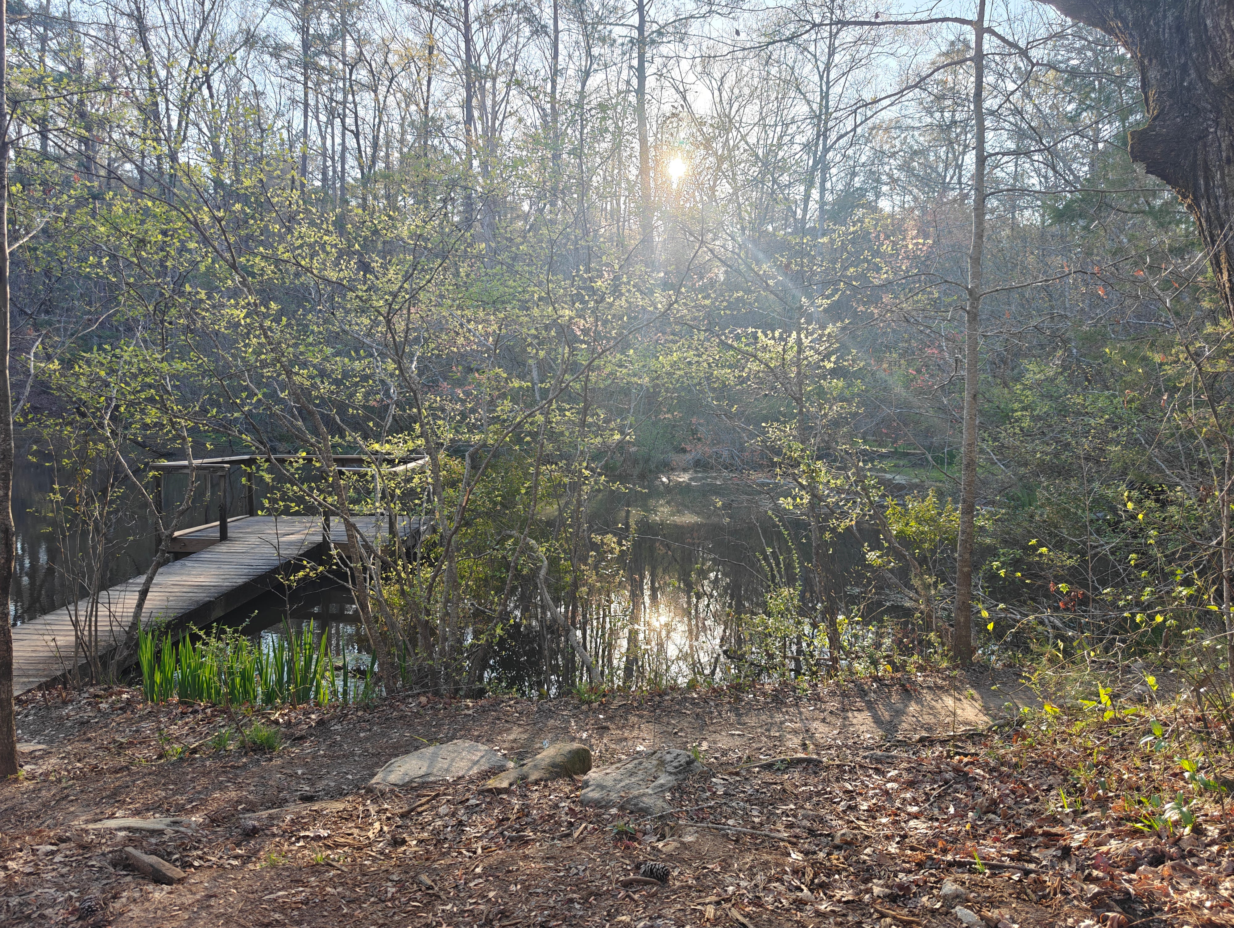
The defining feature of these systems is time. Water doesn’t rush through wetlands. It lingers and hangs out. It’s muddy and oozy. In bogs and boreal peatlands, hydrologic residence time can be years-to-decades for shallow water, and decades-to-centuries for deeper pore water. That long residence is the recipe for ecological success. The secret sauce.
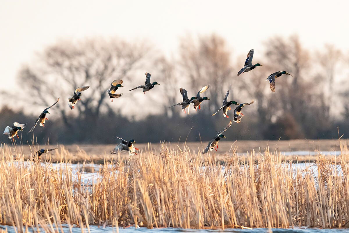
As water ‘cooks’ in the wetland crockpot, ecological life thrives. Migratory birds require these areas for summering and wintering habitats, and they use them throughout their entire flyways (Haig et. al. 2008). Migratory fishes, like Chinook salmon smolts, use them as gas stations (filling up on calorically-dense schools of zooplankton) during their long out-migrations to salty water (Jeffres 2011). Animals from the surrounding landscape use them seasonally to protect eggs, forage, or otherwise hide from predators. The habitats are loaded with herpetofauna: turtles, snakes, frogs, salamanders, alligators. Plant life is impressive and unlike that of the other biomes. Pitcher plants, sundew, wild rice, baldcypress and tupelo trees with huge ‘knees’. One baldcypress stand in the Three Sisters Swamp (Black River, NC) contains contains trees dated at >2,600 years old. All of this life is a product of the water’s time. Slow water builds rich biosystems.
At the macroscale, wetlands work like a sponge on the landscape. They are the kidneys of our lands. They absorb excess water during storms and release it slowly. They filter and trap sediments, nutrients, and pollutants before hitting populated downstream and coastal areas. In Minnesota, former MNDNR Research Scientist Peter Jacobson famously extolled the need to ‘protect the sponge’. This was often in reference to riparian areas surrounding the lakes. However, that need is general across our planet. The natural infrastructure of wetlands does hard work for us all, for free.
"Protecting the sponge, the forest land cover and its underlying geology, is absolutely vital to our coldwater fisheries. And it is this fisheries resource that is the foundational to our region's as well as our state's tourism economy". ~Peter Jacobson, MN DNR Fisheries Senior Research Scientist

These systems worked remarkably well. Perhaps too well. Because as human populations grew, we became predictably frustrated by the difficulty of working and living around wetlands. ‘Progress’ was stymied. Wetlands were hard to farm, hard to build on, and hard to control. And so a different idea rose in the zeitgeist. Not to protect the sponge, but to kill it.
“a miserable morass where nothing can inhabit.” ~William Byrd II (in 1728, describing the Great Dismal Swamp, VA/NC)
So, over the last two centuries, these landscapes were systematically wiped out. In a landmark paper, Dahl 1990 quantified the amount of wetland loss experienced in U.S.A. states. For this essay, I went back through records and tried to update these estimates with data and statistics published from 1990-Present. The United States lost almost half of its original wetlands, roughly 48.7% per state on average. In seven states, >80% are gone (Table 1): the largest losses, ranked in descending order occurred in Ohio, California, Iowa, Missouri, Illinois, and Indiana. The good news is that there has not been too much decrease in wetland coverage during 1990-2026; only a -0.34% loss on average.
Because these big changes occurred over generations, few today even realize they live in landscapes that should actually be wet, but are now engineered to be dry. Entire regions that once absorbed and stored water were systemically drained and filled.
What We Lost By Killing Sponge?
Wetlands are one of the critical life support organs for Earth. Aside from their filtering capacity, they are extremely productive environments for fish, wildlife and biodiversity. In fact, my guess is that most people who are activists for wetlands, came to that place, by first being users of them. Hunting, fishing, canoeing, birdwatching, and more, are common activities because there is so darn much to see there.
Wetlands are estimated to be some of the most valuable ecosystems on the planet. If you include coastal marine areas and rivers and lakes, Constanza et al. 1997 estimated wetlands globally, were worth at least $19.15 trillion annually ($36.4 trillion adjusted for inflation to 2026 values). That value is 58% of the entire natural capital of Earth as presented in their paper. Yet these habitats account for only 1.6% of the Earth’s surface. Dang. Let those numbers sink in! Below is an abbreviated list of their greatest hits:
Store water during storms: Allows floodwater to spread and hold, reducing peak flows and downstream flooding.
Release water slowly: Increases residence times thereby sustaining soil moisture and steady surface water flows. During droughts, this creates a buffering effect that keeps streams and lakes going during the tough times.
Filter nutrients and pollutants: Removes nitrogen, phosphorus, sediments, and contaminants before they reach rivers, lakes and drinking water sources. In a nutshell, wetlands are a giant filtration device.
Groundwater recharge: Promotes infiltration and maintenance of shallow aquifers. Groundwater is handy to have access to, especially when surface water supplies run lean - just ask Arizona, California or the prairie states.
Stabilizes land and reduces erosion: Wetlands trap sediments and protect soils from being washed away. Keeping soils wet results in less land subsidence from human use, especially after groundwater pumping. Check out this insane image of observed land subsidence in the Central Valley.
Supports high biodiversity: Provides habitat for organisms across all levels of biological organization: microbes, plants, insects, amphibians, reptiles, birds, fish, and mammals. There is so much activity, that weekend are sometimes referred to as “biological supermarkets”, meaning everything is attracted to them for food.
Fuels complex food webs and fisheries: I've studied this one for a long time and it is one of the most common patterns you will find in aquatic ecosystems and fisheries. Almost everything uses wetlands as nurseries and energy sources. Want more baby walleye? - wetlands, more alligator gar? - wetlands, more salmon? - wetlands (floodplain to be precise), more trout? - wetlands (beaver ponds), more snapper? - coastal wetlands. Habitat drives wildlife and fisheries abundance (Sass et al. 2017), and wetlands are a really important type of habitat for fisheries and aquatic ecosystems.
Store carbon in soils and vegetation: Especially in peatlands and marshes, carbon can get locked away for long periods. That can be useful.
Moderate local climate and temperature: Retains moisture, reduces heat extremes, and influences microclimates. In western regions, wetlands contribute to slowing and mitigating mega-wildfires (Fairfax and Whittle 2020).
Reduce risk and infrastructure costs: Provide natural flood control and water treatment that would otherwise require engineered systems.
Support livelihoods and working landscapes: Enable agriculture, fisheries, and recreation when integrated thoughtfully.
So, wetlands operate at the seam of life, land, and water. When we remove them, all these key connections unravel and break. Sometimes the failure point is rapid, but in other cases, delicate ecosystems just wither and die slowly. In the end, these shifts play out again and again across wetland landscapes.
Iowa Wetlands
Most people don't think water when they think about Iowa. However, this region was historically a very wet landscape. Iowa’s historic wetlands were among the most extensive and unique in the Midwest, shaped primarily by lobes of the last glaciation. It was an crazy impressive mosaic of prairie potholes, marshes, glacial lakes, and other puddle-like depressions. These were not scattered and isolated features, but a dense network of wetlands embedded within tallgrass prairie. There were scads of tiny prairie basins filled with snowmelt and rain, storing water for weeks or months before slowly releasing it into streams or the ground. Sadly, few pictures exist of these bygone places.
The Meskwaki Nation lived within this mosaic of wetlands, rivers, and prairie. They harvested fish, waterfowl, and plants while moving with the seasons of Iowa water. Wetlands were not marginal land, but the center of a working and living system. The history of Meskwaki resistance to displacement from these lands is worth exploring. This video is a good resource for learning about the important history of their people.
Over the past 150 years, that wet landscape has almost entirely deteriorated. An estimated 89-95% of Iowa’s original wetlands were drained, primarily through subsurface tile drainage and ditching to support row-crop agriculture.
Drainage has almost eliminated prairie marshes in private ownership. A recent survey by the Iowa Conservation Commission indicated aproximately 10,500 acres of marsh and undisturbed uplands. Of this, only about 5,000 acres are actual water. ~Bishop 1981
Today, the state functions essentially as an engineered drain, where water is moved off the land as quickly and efficiently as possible (an inverse to how wetlands naturally operate). And of course, without the storage and filtering capacity of wetlands, water moves quite fast, and carries many more nutrients, particularly nitrogen. This causes harmful algal blooms locally (and far away) and human health issues (Nitrogen in excess is carcinogenic). Chris Jones and Art Cullen are important Substackers to look at if interested in learning more about these issues.
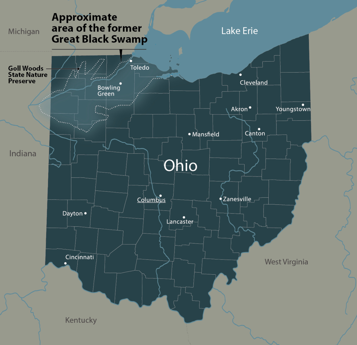
Great Black Swamp
The Great Black Swamp once stretched across roughly 1.5 million acres of northwestern Ohio and northeastern Indiana. It was a vast, mostly forested wetland, left behind by the retreat of glaciers. It was not open water wetland so much as a saturated landscape: wet-to-very wet soils. There were dense stands of burr oaks, elm, and ash growing from the poorly drained Earth, interlaced with shallow pools, sloughs, and slow-moving water. Rain and snowmelt spread out across the region and “hung out”, moving slowly toward Lake Erie through a forested hardwoods maze. Early settlers saw it as impenetrable and wretched; malaria was common. There are many accounts of miserable soldiers hiking and camping in the swamp during the War of 1812.
For Indigenous nations such as the Wyandot Nation, Shawnee Tribe, and Miami Tribe, the Great Black Swamp was not in the way, but a living system. A source for food, movement, and memory across generations. Like Tulare Lake, the decline of the swamp paralleled the decline of the native peoples. The swamp was dismantled and siphoned off in stages and its peoples in similar ways. Through successive ‘treaties’ and ultimately forced removals, communities were pushed west. Almost drained themselves.
“Here are our homes… here too are the graves and bones of our fathers,” ~Unknown Wyandot leader during removal negotiations.
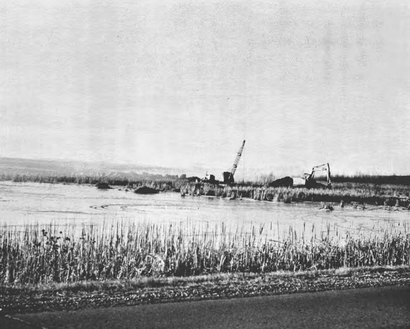
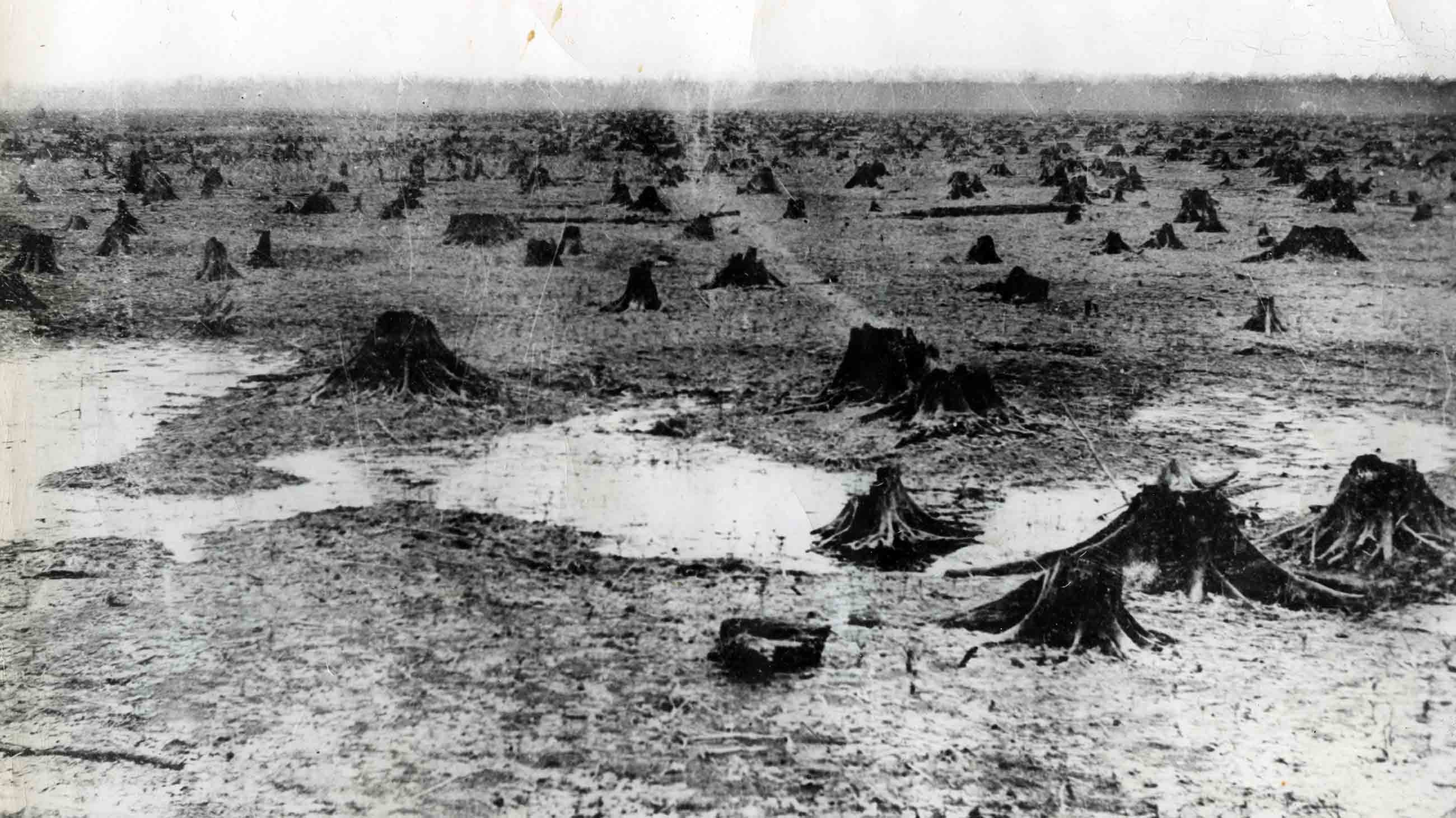
That system was dismantled with remarkable speed in the mid-to-late 1800s. Using an extensive network of drainage ditches and subsurface tile lines, the swamp was effectively wrung out. Its water routed into straightened channels and carried quickly to the Maumee River and ultimately Lake Erie. Today, >90% of the original wetland is gone, replaced by some of the most productive agricultural land in the United States. But the transformation came with consequences that are still unfolding. Without the swamp’s ability to slow and filter water, nutrients move rapidly off the landscape, contributing to harmful algal blooms in Lake Erie. What was once a slow, absorptive ecosystem is now a fast, exporting one. The land never changed, but the movement of water did.
The Mississippi Alluvial Valley
The historic floodplain and valley of the lower Mississippi River once formed one of the largest continuous wetland systems in North America. It was a a 24.7-million-acre system, roughly the size of Indiana - a mosaic of forested wetlands, swamps, cypress–tupelo brakes, scrub-shrub zones, and emergent marshes. These wetlands and floodplains stretched from southern Illinois to the Gulf. Before levees and large-scale drainage, the river regularly flooded, spreading water across these millions of acres of bottomland hardwood forests.
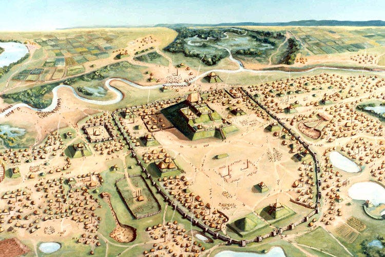
Floodplains of the Mississippi Alluvial Valley supported impressive Indigenous societies for millennia, including Mississippian mound building communities (ca. 800–1600 CE) and later historic tribes such as the Choctaw, Chickasaw, Quapaw, and Natchez. Floodplains provided fertile alluvial soils for maize-based agriculture, extensive fisheries in side channels and oxbows, and rich hunting grounds for waterfowl and large mammals. These systems formed the ecological foundation of large, complex settlements such as Cahokia, located just east of modern St. Louis. Seasonal flooding shaped lifeways over thousands of years, structuring planting cycles, travel routes, and settlement placement on natural levees. It also shaped deep cultural connections to riverine landscapes, including sacred sites and burial grounds tied to the rhythms of the river.
That system, like so many others, was radically transformed. More than 80% of the valley’s original wetlands is now cleared, drained, or disconnected from the river. Levees confine the river to its channel, preventing it from accessing its historic floodplain. This deepened the channel and increased flood intensity, especially when levees fail. What was once a distributed, squishy landscape, is now a fully constrained and accelerated one.
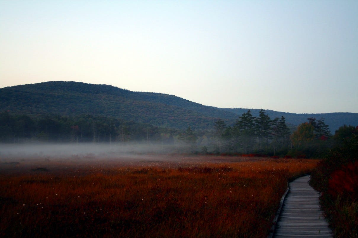
Southern Appalachian Bogs
Deep in the Appalachians of the Carolinas and Virginia is another kind of wetland most people have never heard of. These are largely groundwater-dominated systems, known as ‘fens’, though some are surface- or rainwater-fed systems, or true ‘bogs’. Positioned on the lower and flatter portions of the mountains, they are tiny - often just 0.5 to 5 acres in size.
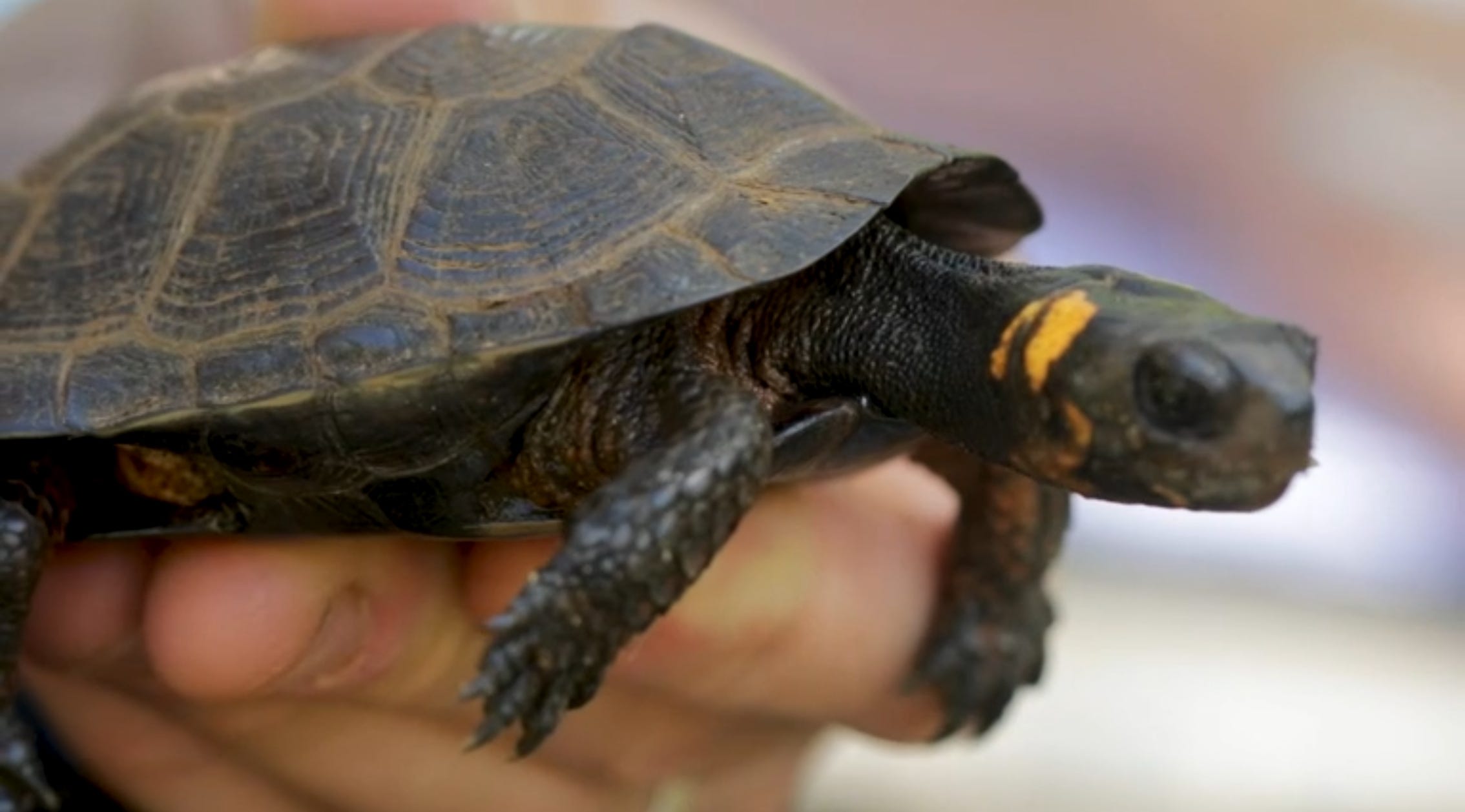
These mountain wetlands are among the rarest and most endangered ecosystems in the Southeast. Part of what makes them so special are the plants and animals that live inside and depend on them. Mountain cranberries, sphagnum moss, pitcher plants, and cotton sedges. The southern bog turtle, North America’s smallest turtle. Even flying squirrels. This is only a small sampling of the diversity contained in these systems.
But their isolation is also their vulnerability. Small wetlands are especially key to biodiversity conservation broadly (Gibbs 2001). After all, these species have nowhere else to go. Conservation must occur locally and include the entire ecosystem, which makes it difficult.
Estimates vary, but roughly 90-98% of these habitats have disappeared. The mountain fens/bogs are especially vulnerable because their locations are so desirable. These low, flat areas are often the best areas in the mountains for farming and grazing, and even for towns. And because these systems are so small, they are exceedingly easy to drain.
Other impacts are hard to see, but nonetheless devastating. These wetlands depend on delicate unseen balances of groundwater flow, soil chemistry, and nutrient inputs. Small changes from upstream farming or development can disrupt the balance and dismantle the system from the bottom up. Climate change, invasive species, and fire suppression all seem to lead to the same place. An open fen becomes enclosed by trees. The system closes in on itself, and disappears.
The Everglades
South of Lake Okeechobee, water still spills over the lake’s rim and begins a slow journey toward Florida Bay. Because the land is so flat, water moves extremely slow; sometimes just 50 feet (15 m) per day. It moves as a wide sheet, blanketing and advancing over the swamp. Water crosses dense stands of sawgrass, deeper sloughs, and tree islands with mature baldcypress. American alligators excavate depressions that hold water through the dry season. Wading birds like wood stork, great egret, and roseate spoonbill track shrinking pools, concentrating on the stranded fishes.
The system still works like this, but it used to be so much larger. It was an immense place.
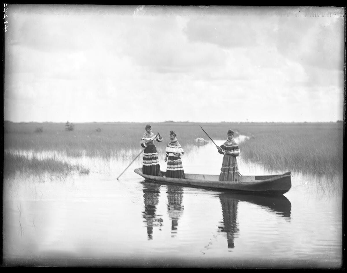
For thousands of years, Indigenous peoples including the Calusa, Tequesta, Seminole, and Miccosukee lived within and adapted to this landscape, relying on its abundant fisheries, wildlife, and plant resources. The Seminole, in particular, built chickees, raised open-sided structures on tree islands, and navigated the wetlands by canoe, fishing, hunting, and gathering in step with seasonal water levels. The Everglades also served as a refuge during the Seminole Wars, where deep knowledge of the landscape allowed communities to persist despite intense removal efforts.
During the late 1800s, a Philadelphian entrepreneur named Hamilton Disston, heir to a sawmill fortune, became the first to attempt to drain the Everglades. Disston purchased roughly 4 million acres of Florida in 1881. His canal-building projects opened the region to settlement and transportation, triggering Florida’s first major land boom and enabling the growth of several towns. However, his drainage efforts largely failed to significantly lower water levels in the Everglades and around Lake Okeechobee. Even so, his investments primed Florida’s economy and set the stage for later development by railroad magnates and the rise of tourism and agriculture.
The Everglades were reworked during the early- to mid-1900s into a fully managed landscape. It is one of the few water systems in the United States comparable in scale and manipulation to California. The Central and Southern Florida Project cut canals and raised levees to drain land and control flooding, breaking the formerly continuous sheet flow into compartments. Water that once lingered across marshes was rerouted, stored, and released on schedules. Hydroperiods changed. Tree islands dried or burned. Wading bird colonies collapsed from historic levels.
Today, large portions of the Everglades operate under active hydraulic control, and restoration efforts aim to push water back onto the landscape in ways that approximate past ecological function. But the system that remains is hybrid. It is part marsh, and part machine.
The Everglades were reduced from about 3 million acres historically to roughly 1.5 million acres today. Most of the lost area was converted to agriculture, especially the Everglades Agricultural Area south of Lake Okeechobee. Urban development along Florida’s coasts also contributed and continues to expand.
Water still moves here, but no longer on its own terms.
California
The same story appears in California. Tulare Lake, once the largest freshwater lake west of the Mississippi, was drained and converted to agriculture. I have written about this system in more detail elsewhere.
In northern California, the pattern repeats. Wetlands throughout the Central Valley were pumped and drained.
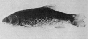
Today, 83% of native fishes in the state are at risk of extinction if current trends continue. The Delta Smelt is now functionally extinct in the wild, another likely victim of wetland loss and hydrologic alteration.
What was once a system that held water across the landscape has been engineered to move it quickly through it.
Different Places, Same Story
By now, the motifs of the vignettes are becoming clear. On the surface, these places seem very different from one another. Different climates, species, hydrology, and people.
The played pattern, however, is catholic.
Throughout the 19th and early 20th centuries, U.S. policy enabled the deletion of wetlands. Laws like the Swamp Land Acts transferred millions of acres of “waste swamplands” to the states on the condition they be drained. Meanwhile, the Homestead Acts incentivized settlers to convert land of all ecotypes into farms. The forceable removal of Indigenous peoples, many of whom valued wetlands more than the settlers, only quickened the speed of socioecological change.
We took landscapes shaped over millennia to slow and hold water, and turned them into the opposite. We divorced the land from the water by draining, ditching, tiling, and straightening. The people who did this work were not necessarily malicious. They were responding to the incentives of their time. Many believed they were improving the land by clearing and draining what they saw as nuisance swamps.
Yet the ecological response of the divorce was predictable. Bird populations declined. Fish populations disappeared. Insects diminished. Across systems, natural communities unraveled. It is not difficult to see how these changes contribute to the freshwater biodiversity crisis we face today (Harrison et al. 2018; Rypel and Moyle 2024).
Defending Instead of Draining
By the mid-1900s, scientists and conservationists started to recognize the special ecological importance of wetlands. Evidence increasingly showed these systems were not condemned or valueless lands, but rather key and necessary parts of healthy landscapes.
During the 1970s, U.S. policy amazingly changed course. Passage of the National Environmental Policy Act in 1970, followed in quick succession by the Clean Water Act in 1972 meant wetlands had standing, and were deemed worthy of protecting. Now, anytime people wanted to fill, drain, or erase these places, justification was needed. Then passage of the Endangered Species Act in 1973 added another essential tool. Protecting rare and declining species from extinction necessitated the protection of critical habitats - in many cases these are wetlands. The Southern Bog Turtle and its tiny scraps of mountain bog habitats is a good example of that. All three of the above bills passed under the Richard Nixon administration. Then, farm policy followed, stripping away incentives for wetlands conversion via The Farm Bill “Swampbuster” provision in 1985 (Under the Ronald Reagan administration). A new federal goal of “no net loss” (announced by President George HW Bush) in 1989 reframed wetlands as assets to be maintained in totality. The North American Wetlands Conservation Act added a different and new tool: money. It installed an instrument for restoration, funding projects across the continent and tying wetland protection to migratory bird conservation, where effects of habitat loss were impossible to ignore.
Recently, the rising respect for beavers has been nice to see (Goldfarb 2018). Beavers were once among the most important builders of wetland systems in North America. Pre-European populations likely ranged from 60 to 400 million, compared to just 10 to 15 million today, an 85–97% decline that closely mirrors wetland loss. By building dams, beavers slow water, spread it across the landscape, and create wetland habitat. Restoring even a fraction of these populations would greatly expand wetlands and benefit fish, wildlife, and water systems.
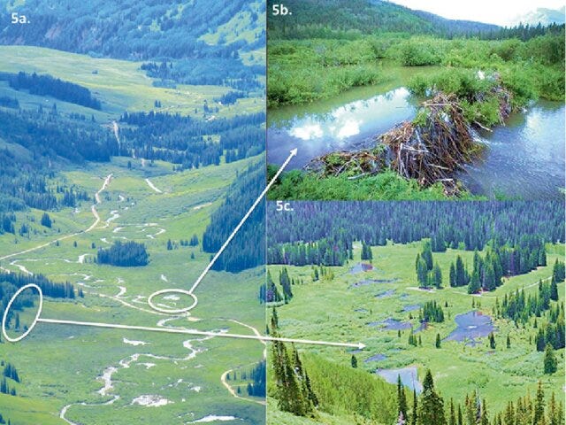
But this is not a simple solution. Beaver activity can flood fields, roads, and infrastructure, creating real conflict with landowners. That tension sits at the heart of modern landscape management. Still, beavers offer a glimpse of what these systems once were, and what they could become again. With thoughtful management, they can help rebuild pieces of the sponge we removed.
The Sackett Decision: What is it? Why does it matter?
The Supreme Court’s 2023 decision in Sackett v. Environmental Protection Agency marked a major shift in the trajectory of U.S. wetland protection. Sackett effectively limited federal jurisdiction of wetlands to those with a clear, continuous surface connection to navigable waters. By doing so, the Court narrowed the reach of the Clean Water Act and excluded vast areas of seasonally flooded or hydrologically-connected landscapes. As discussed throughout this essay, wetlands are often supported by seasonal or below ground hydrologics. Think about the mountain bogs - clearly a wetland, but sometimes their above ground connection to navigable waters is weak or non-existent. Under Sackett, such systems receive no federal protections.
In practice, the Sackett decision pushed clean water regulatory authority back to states. Some states are very protective of their wetlands - others less so. So, we are left with a patchwork of protections across the U.S. where some wetlands remain safeguarded while others are newly vulnerable. Context is important though. Within the longer arc, it feels less like a full reversal than a loosening: the legal barriers that once rose to prevent wetland loss are thinner, but there are still good fundamental protections.
Resurrection and the Fallacy of Limitless Resources
There was once a wetland near where I grew up in Wisconsin. A large field that turned out to be excised floodplain of the Fox River, just down the road. We played there as kids: catching frogs, flipping logs, chasing salamanders and garter snakes through the mud and tall grass. I carry a scar on my right hand from dropping a log on it in that field. At the time, it felt like a secret patch of wildness. Something endless and alive - and always waiting for us.
I was 13 when it was filled, leveled, and converted to commercial property. It didn’t feel like a loss of infrastructure at that time. It felt like it killed one of the remaining slow and innocent parts of me. In reality, it was both.
As I worked on this essay over the past few weeks, I kept returning, again-and-again, to the following thought. We didn’t just drain off wetlands, we fundamentally misunderstood them.
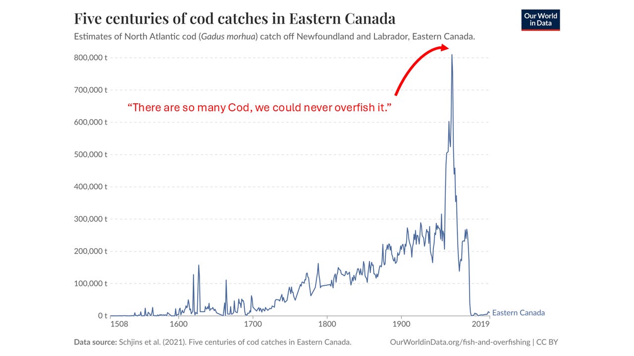
One of our great recurring mistakes as a species is overestimating the abundance of nature. We assume many things are so large, common, and resilient that our actions could never meaningfully have an impact. Run down the list on how this thinking is almost always wrong: marine overfishing, excessive groundwater pumping, microplastics, market duck hunting, the effects of dams, even our attitude toward the planet’s climate.
Wetlands clearly also apply here. They were everywhere, but inconvenient and easy to dismiss. So we drained them off: one-by-one. In their place, we almost immediately began engineering expensive, energy-intensive substitutes for the very functions wetlands once performed for free. The consequences are now all around us. Water that moves too fast and floods too much. Nutrients and toxic chemicals that go where we don’t want them to go - into our lakes, our coasts, even our bodies. Fewer fish. Fewer animals. More brittle ecosystems. None of this is a coincidence. Nor should it be surprising. It is the logical endpoint of rewiring how water moves across Earth. But there is an important counterpoint to this story, and it’s one you rarely hear.
If wetlands were destroyed through misunderstanding, they can also be resurrected by truly understanding them. Today, we actually can/do understand how these systems work. We can measure residence time, nutrient cycling, flood attenuation, and food web dynamics. We know landscapes work better when water is allowed to linger, and we have good tools to design and maintain ecological function. We can create new wetlands.
During an era of increasing uncertainty, this may seem odd, but the door to a new and bright future is much more open than most realize.
Agriculture, for example, does not have to remain locked into the rapid export of water and nutrients off the land. Across the U.S., where water quality problems seem chronic and intractable, reintegrating wetlands can be part of the answer. Using modern science and engineering to strategically slow water down can help to deliver on the promise of working lands. And if dreaming big - why be small about it? Why not explore the idea of large wetland restorations when the opportunities presents themselves? Smaller scales practices (at the farm level) can also be effective in the aggregate. Existing federal agencies like NRCS, and its CRP and EQIP programs, can help regrow wetlands, either seasonally or for long periods. We simply need smart people willing to connect the dots.
To be clear: this is NOT a return to the past, rather a redesign of the present. It is reconciliation ecology.
In Alabama, where I now work, there are hundreds of thousands of private ponds. Most are managed for fishing or aesthetics. But collectively, they represent an enormous, largely untapped opportunity to recover additional fragments of lost wetland function, if we are bold enough to see them that way.
We do not have to create exact replicas of lost wetland to change the trajectory. But we do have to change how we think. For the past two centuries, we managed landscapes as if water should move quickly and efficiently out of sight. By looking back, we can learn about alternatives that are slower and more patient. Ones that work more like a sponge.
And perhaps that is the deeper lesson here. Wetlands are not just ecosystems. They are beautiful but ghostly reminders about the perils of speed we seem to prize so dearly in modernity. In the end, these conveniences don’t seem well-aligned with how the natural world works best - with how our bodies and ecology work best. Maybe, we need to slow down in general.
When future generations look back on us, they will likely see both sides of this story better than we currently do. To be slow - sometimes that matters. Because the sponge is not gone, but it is much thinner now. The bit of sponginess and slowness that remains is therefore more valuable than ever before.
“In our frailty, our insecurity, we tend to view ourselves as the zenith of creation, as a shining pinnacle of evolution, as the only essential being. This perspective tends to dominate our study of history and colors our relationships with all life.” ~George Folkerts (Okefenokee)
Author's Note: Forgive me for the more American focus of this essay on wetlands. That focus in no way indicates a lack of interest in wetlands elsewhere. These too are so very important and also deserve exploration.
Other interesting wetland ecosystems, topics, and side quests I wanted to talk about, but that made this piece more dreadfully longer:
The importance and disappearance of wild rice
The strange practice of “peat harvesting”
How energy moves reciprocally between wetlands and the surrounding landscape
Spring ponds in Wisconsin (native brook trout live here)
Desert wetlands, like those in the Amargosa River basin
Great Lakes wetlands including drowned river mouths and such
The importance of wetlands to insects in particular - links to the insect apocalypse?
Methane and greenhouse gases
Hippos!
Go Deeper
Constanza, R., R. d’Arge, R. de Groot, S. Farber, M. Grasso, B. Hannon, K. Limburg, S. Naeem, R.V. O’Neill, J. Paruelo, R.G. Raskin, P. Sutton, M. van den Belt. 1997. The value of the world's ecosystem services and natural capital. Nature 387: 253-260.
Dahl, T.E. 1990. Wetlands losses in the United States, 1780's to 1980's. Department of the Interior, Fish and Wildlife Service, Washington, D.C. 21 pp.
Douglas, M.S. 1947. The Everglades: River of Grass. Rinehart & Company.
Fairfax, E., and A. Whittle. 2020. Smokey the Beaver: beaver-dammed riparian corridors stay green during wildfire throughout the western United States. Ecological Applications 30: e02225.
Folkerts, G.S. 2002. Okefenokee. University Press of Mississippi.
Gibbs, J.P. 2001. Wetland loss and conservation. Conservation Biology 14: 314-317.
Goldfarb, B. 2018. Eager: The Surprising, Secret Life of Beavers and Why They Matter. Chelsea Green Publishing.
Haig, S.M., D.W. Mehlman, and L.W. Oring. 2008. Avian movements and wetland connectivity in landscape conservation. Conservation Biology 12: 749-758.
Harrison, I., R. Abell, W. Darwall, M.L. Thieme, D. Tickner, and I. Timboe. 2018. The freshwater biodiversit crisis. Science 362: 1369.
Jeffres, C. 2011. Frolicking Fat Floodplain Fish Feeding Furiously. California Waterblog https://californiawaterblog.com/2011/06/02/frolicking-fat-floodplain-fish-feeding-furiously/
Levy, S. 2017. Learning to Love the Great Black Swamp. Undark Magazine.
Rypel, A.L. 2023. Wetlands On the Edge. California Waterblog https://californiawaterblog.com/2023/09/03/wetlands-on- the-edge/
Rypel, A.L. and P.B. Moyle. 2024. Watching Native Fishes Vanish. California Waterblog https://californiawaterblog.com/2024/09/01/watching-native-fishes-vanish/
Rypel, A.L. 2025. Ooze, Order and Disorder: A Perspective On the Complicated Nature of Nature. Tangled Nature https://tnature.substack.com/p/ooze-order-and-disorder
Rypel, A.L. 2026. America's Ghost Lake. Tangled Nature https://tnature.substack.com/p/americas-ghost-lake
Rypel, A.L. 2026. Five Cool Fishes That Went Extinct. Tangled Nature https://tnature.substack.com/p/five-cool-fishes-that-went-extinct
Sass, G.G., A.L. Rypel., and J.D. Stafford. 2017. Inland fisheries habitat management: Lessons learned from wildlife ecology and a proposal for change. Fisheries 42:197-209.
Wan, L., E. Fairfax, and K. Maher. 2025. Factors influencing surface water accumulation in beaver pond complexes across the Western United States. Communications Earth & Environment 6: 614.
https://www.ducks.org/conservation/where-ducks-unlimited-works/mississippi-alluvial-valley
https://www.pbs.org/video/bog-turtles-big-trouble-for-our-smallest-turtle-ci8xqd/
Greeting from Thailand, this is a very great post I read in a long time. Can I translate your post in Thai language and share to my Thai people out there? I will cite you in the translated post.
Outstanding post. The table with the Dahl information and an update seems like an important resource! All the top converter states look to be major ag states.